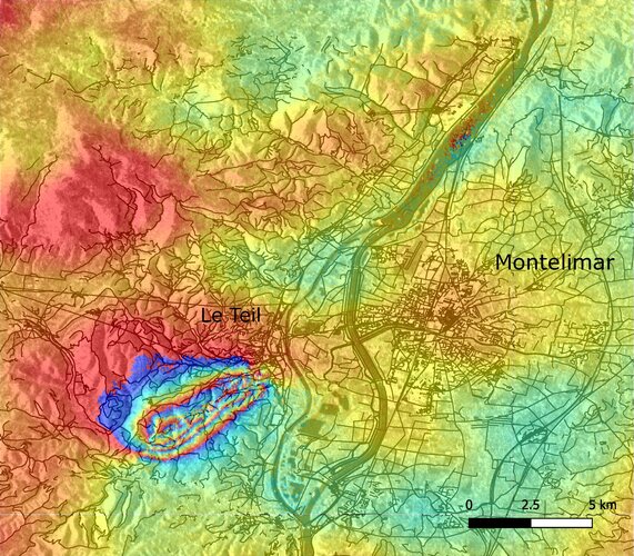
This week, southeast France was hit by a magnitude 5 earthquake with tremors felt between Lyon and Montélimar. The Copernicus Sentinel-1 radar mission has been used to map the way the ground shifted as a result of the quake.
Click here for original story, French earthquake fault mapped
Source: ESA Space News