To improve the understanding of current trends in global urbanisation, ESA and the German Aerospace Center (DLR), in collaboration with the Google Earth Engine team, are jointly developing the World Settlement Footprint – the world’s most comprehensive dataset on human settlement.
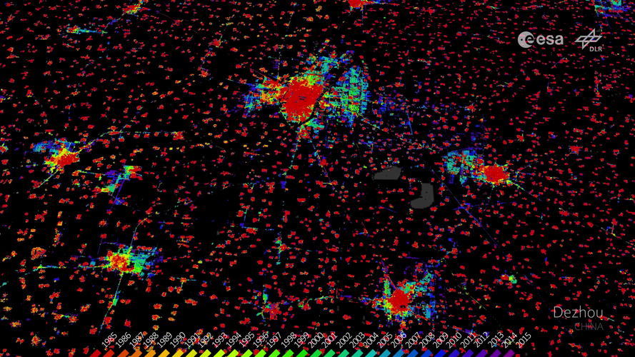
The video features several examples from the World Settlement Footprint Evolution, which has been generated by processing seven million images from the US Landsat satellite collected between 1985 and 2015 and illustrates the growth of human settlements on a year-by-year basis in selected cities.
Read the full story: Mapping our human footprint from space
Click here for original story, World Settlement Footprint
Source: ESA Top Multimedia