Image:
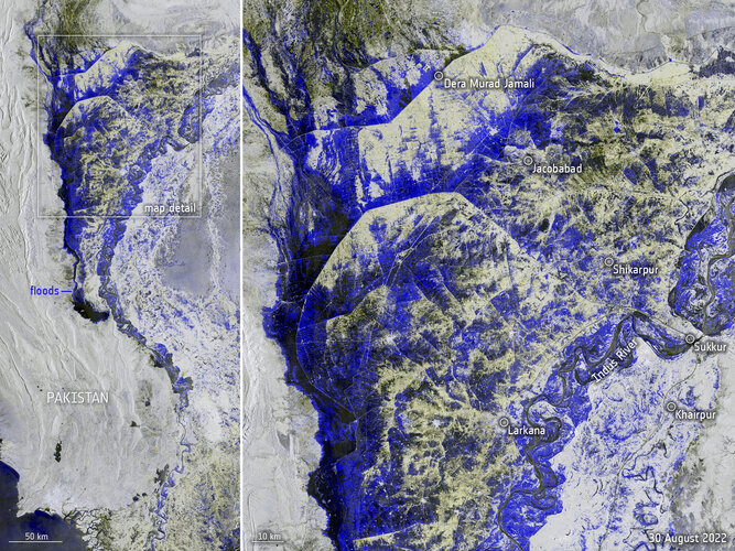
Data captured from space by Copernicus Sentinel-1 on 30 August was used to map the extent of flooding that is currently devastating Pakistan .Heavy monsoon rainfall has led to more than a third of the country now being underwater.
Click here for original story, Pakistan inundated
Source: ESA Space News