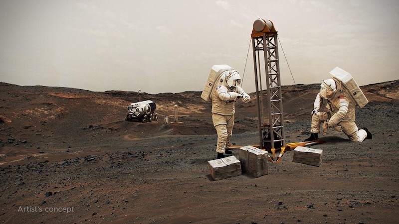
Mars has a lot of water ice, both on the surface and underground. But most of the surface ice is at the planet’s poles. So buried subsurface ice in other places across the planet will someday be an important resource for future Mars astronauts. In late October 2023, NASA said it has released the newest version of its water ice on Mars map. The NASA-funded Subsurface Water Ice Mapping project – aka SWIM – started releasing the maps back in 2017. This is now the 4th version of the map. The map will help future visitors to the red planet decide on the best landing spots. They’ll use maps like this one to know where ice can be drilled and extracted. How is this map better than previous versions? Keep reading …
The Planetary Science Institute (PSI) in Tucson, Arizona, leads the SWIM project and NASA’s Jet Propulsion Laboratory (JPL) in Pasadena, California, manages it.
The 2024 lunar calendars are here! Best Christmas gifts in the universe! Check ’em out here.
Data from several NASA missions
The new map uses data compiled from several different NASA missions, including the Mars Reconnaissance Orbiter, Mars Odyssey and Mars Global Surveyor, which is no longer active. The primary purpose of the map is to identify the most likely places for buried ice.
The data show that the ice is close enough to the surface that astronauts could access it. We known that much of the ice is in the mid-latitudes, the northern mid-latitudes in particular.
Finding the best locations of ice on Mars
The northern mid-latitudes would be the most ideal for future human missions. This is because the atmosphere is slightly thicker over these regions, which would help a descending spacecraft to land safely. But the best locations would also be ones closest to the equator, where temperatures are warmest. Sydney Do, JPL’s SWIM project manager, said:
If you send humans to Mars, you want to get them as close to the equator as you can. The less energy you have to expend on keeping astronauts and their supporting equipment warm, the more you have for other things they’ll need.
A new and improved map of ice on Mars
Previous versions of the SWIM map were able to show where buried ice was probably located, but couldn’t confirm it. They used lower-resolution imagers, radar, thermal mappers and spectrometers than what is available now. The new map, on the other hand, uses data from higher-resolution cameras on the Mars Reconnaissance Orbiter.
The map uses Context Camera (CTX) data to further refine the northern hemisphere maps. Also, for the first time, the map incorporates data from the High-Resolution Imaging Science Experiment (HiRISE) camera. This provides a detailed perspective of the ice’s boundary line as close to the equator as possible.
Craters reveal hidden ice
Sometimes, ice that is below the surface gets excavated naturally by meteorite impacts. HiRISE has found many such ice-containing craters. That would be ideal for astronauts, since not all of the ice would need to be brought to the surface from below. Some is already there! Those ice deposits also act as an “X marks the spot,” showing where more ice is likely just under the surface. As SWIM’s co-lead at the Planetary Science Institute, Gareth Morgan, said:
These ice-revealing impacts provide a valuable form of ground truth in that they show us locations where the presence of ground ice is unequivocal. We can then use these locations to test that our mapping methods are sound.
HiRISE has also viewed polygon terrain on Mars. This is similar to terrain on Earth where expanding and contracting subsurface ice causes polygonal-shaped cracks in the ground. The polygons are another signpost pointing to ice just below the surface.
More icy mysteries
The new map can help scientists solve other mysteries about ice on Mars as well. For example, the subsurface ice is more abundant at mid-latitudes. However, the distribution of that ice isn’t consistent, and actually varies quite a bit. Why? Nathaniel Putzig is SWIM’s other co-lead at the Planetary Science Institute. He explained:
The amount of water ice found in locations across the Martian mid-latitudes isn’t uniform; some regions seem to have more than others, and no one really knows why. The newest SWIM map could lead to new hypotheses for why these variations happen.
The answer may be related to how the Martian climate has changed over billions of years. Due to that variation, more ice may simply have been deposited in some areas and less ice in others.
Mars Ice Mapper
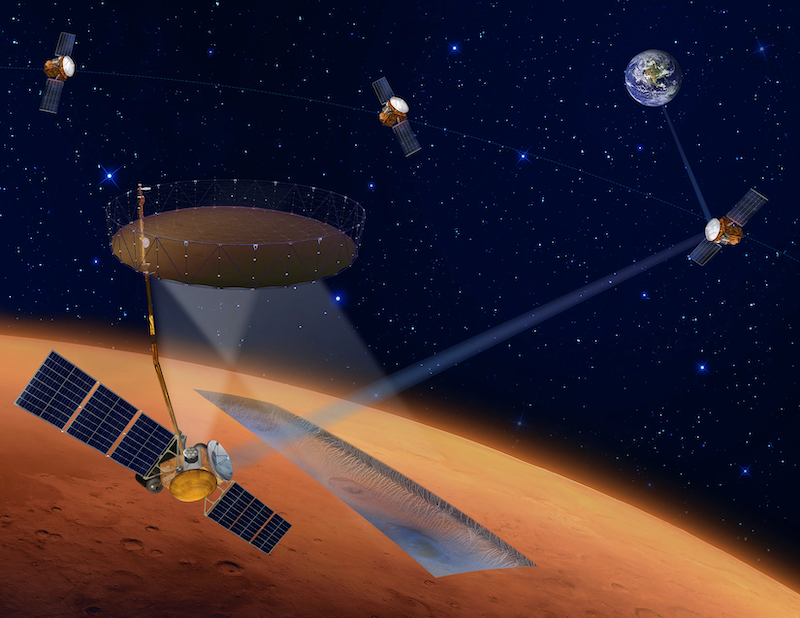
HiRISE has been invaluable in locating deposits, and suspected deposits, of ice on Mars. But there’s always room for improvement. NASA has proposed a new mission called International Mars Ice Mapper (I-MIM). It would continue the work of HiRISE, but custom-designed specifically to locate ice deposits. Finding ice is just one of many of HiRISE’s tasks.
The International Mars Ice Mapper mission would consist of four orbiters: one each from NASA, the Italian Space Agency (ASI), the Canadian Space Agency (CSA) and the Japan Aerospace Exploration Agency (JAXA). If approved, the mission could be ready to launch by 2026. It would detect the location, depth, spatial extent and abundance of near-surface ice deposits.
Bottom line: NASA has released a new map of ice on Mars as part of the Subsurface Water Ice Mapping project. It shows all the known and suspected areas of underground ice.
Via NASA
Read more: Vast underground water ice on Mars
Read more: New evidence for multiple ice ages on Mars