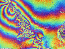
NASA’s ARIA mission used synthetic aperture radar data to produce a map of damage caused by two strong earthquakes that struck southern California over the weekend.
Click here for original story, NASA Maps Surface Changes From California Quakes
Source: NASA Jet Propulsion Laboratory
