Image:
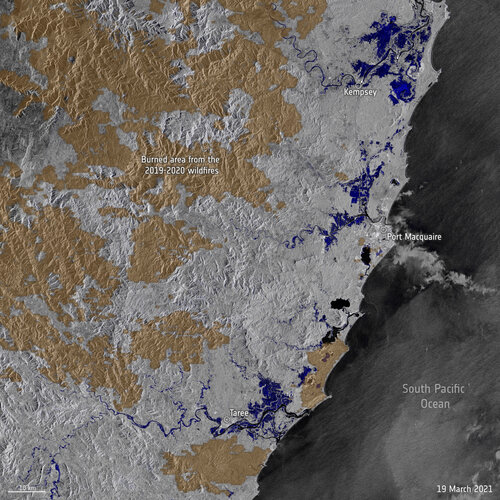
Stretches of land across New South Wales, Australia, have been hit with torrential rain leading to record-breaking floods. Data from the Copernicus Sentinel-1 mission are being used to map flooded areas to help relief efforts.
Click here for original story, Satellites map record floods in Australia
Source: ESA Space News