Image:
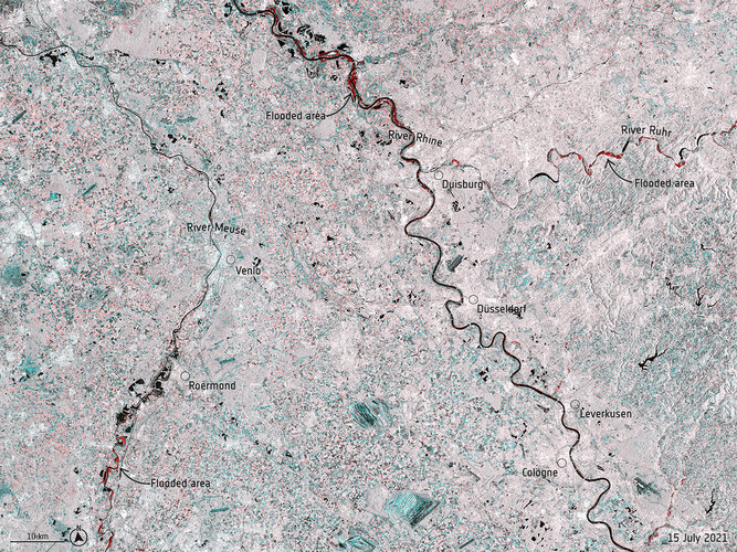
Record rainfall has caused swollen rivers to burst their banks and wash away homes and other buildings in western Europe. Data from the Copernicus Sentinel-1 mission are being used to map flooded areas to help relief efforts.
Click here for original story, Satellites map floods in western Europe
Source: ESA Space News