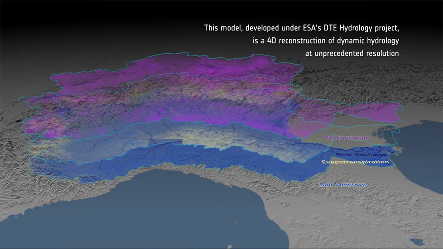
Computer models are used to simulate aspects of the natural world, such as the water cycle within river basins. Satellite observations can be used to improve the accuracy and spatio-temporal detail of hydrological models. Satellite and ground observations are combined with the model in a ‘data cube’ to derive parameters such as river discharge rate. The data cube can be used for water resource management and to identify locations and times of risk.
Click here for original story, Digital Twin Hydrology
Source: ESA Top Multimedia