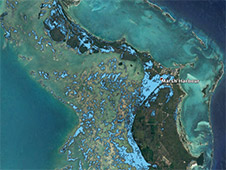
NASA’s ARIA team used satellite data acquired on September 2, 2019 to map flooding on the Abaco Islands in the Bahamas.
Click here for original story, NASA’s ARIA Team Maps Flooding in the Bahamas
Source: NASA Jet Propulsion Laboratory