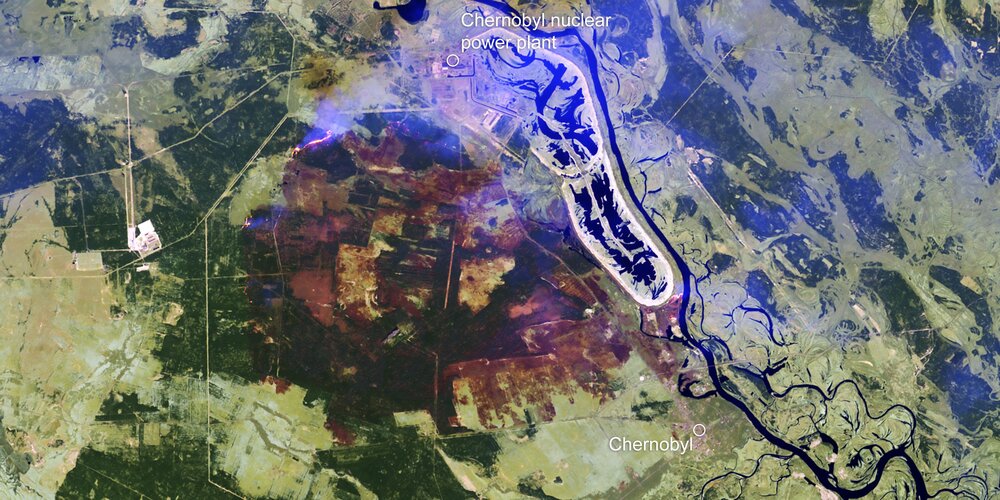
With an outbreak of wildfires recently threatening the closed Chernobyl nuclear power plant in the Ukraine, the Copernicus Emergency Mapping Service has been activated and the Copernicus Sentinel-2 satellite mission has imaged the fires and smoke, and mapped the resulting area of burned ground.
Click here for original story, Mapping Chernobyl fires from space
Source: ESA Space News